
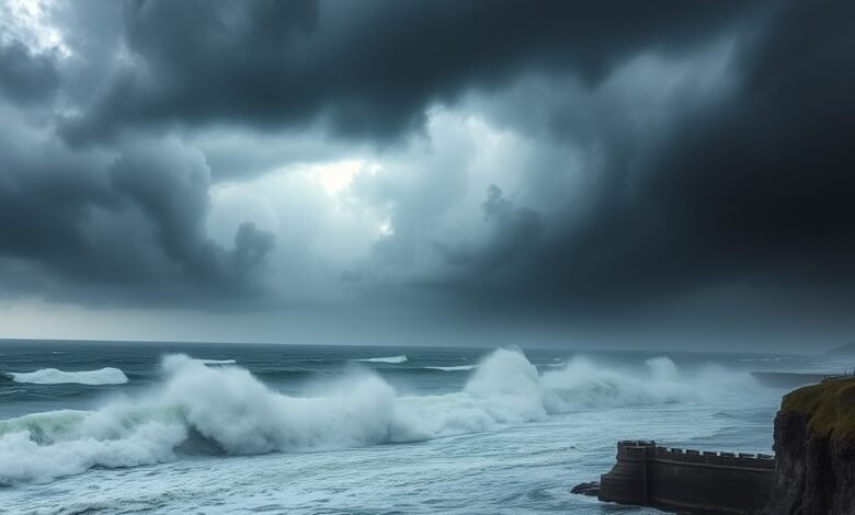
Storm Babet, bringing winds of up to 85 mph, has severely impacted the UK, resulting in ‘devastating’ flooding, power outages, and the death of a man struck by a falling tree.
In the affected zones which include Scotland, parts of Northern Ireland, and the far north of England wind speeds were recorded between 60 and 70 mph.
According to the Met Office, gusts in exposed coastal areas exceeded 80 mph.
Meanwhile, several areas in Scotland have been submerged, and a ‘danger to life’ warning has been issued.
Storm-related damage has forced the closure of multiple railway lines; the tracks at Dalmarnock station are completely underwater, with floodwaters nearing the platform.
In Dumfries, Scotland, a 60-year-old man lost his life this morning shortly after 10:00 AM when a tree fell on him.
Police Scotland stated: “We received a report that a 60-year-old man was struck by a falling tree on a minor road in Mid-Kelton, near Castle Douglas, at approximately 10:30 AM on Sunday, October 25, 2026. The individual passed away at the scene.”
“There are no suspicious circumstances surrounding this incident, and a report will be submitted to the Procurator Fiscal in due course.”
In the Ayrshire town of Largs, flooding has occurred, with footage showing a powerful torrent of water surging through a populated area. A shopkeeper in the town broke down in tears after the floods destroyed her property, forcing her to lose all her stock.
Toni Dawson, who runs ‘Geraldo’s’ an ice cream and gift shop told Sky News: “Within half an hour, the water rose so rapidly that the main road became submerged.”
“We are trying to clear as much debris as we can, and we are placing boards and sandbags in front of the shop.”
The Met Office states that this succession of weather systems hitting the UK is driven by the jet stream, which is currently “unusually active.”
Meanwhile, according to the Energy Networks Association, approximately 83,000 customers across the country have been left without power.
The association stated: “Networks have focused on restoring power to customers this morning; however, in some regions, the persistent severe weather has limited opportunities to safely begin restoration work, and access to certain areas remains difficult.”
In England, a stretch of the A66 spanning approximately 15 miles from near Bowes in County Durham to near Brough in Cumbria has been closed in both directions due to high winds.
Cumbria Police reported receiving numerous calls throughout the night regarding “localized flooding and fallen trees blocking roads.” A spokesperson added that efforts to clear the obstructions are underway and urged motorists to “drive with caution.” Train companies across the country have warned that passengers may face ‘severe’ disruption on Sunday, and people are being urged to avoid rail travel wherever possible.
Meanwhile, in light of the severe weather, airlines have cancelled flights, and ferry operators have also suspended some services.
Storm Babet follows Storm Arwen the first named storm of the season which brought high winds to parts of the UK on Friday.
Striking images show piles of bricks outside homes, shattered windows, and damaged signboards amidst the stormy conditions.
Heavy rainfall, which began at 8:00 AM on Saturday, saw 72mm of rain recorded in Whiteparish, Wiltshire; 43mm in Cwm Dyli (located just south of the Snowdon range in North Wales); and another 43mm in Inveruglas, on the western shore of Loch Lomond in Scotland.
Hundreds of homes remained without power following Storm Arwen, which struck South West England on Friday; the National Grid reported that by 7:00 PM on Saturday, electricity had been restored to 131,225 properties.
An ‘amber’ wind warning the second most severe level issued by the Met Office is in effect from 9:00 PM Saturday until 9:00 PM Sunday, covering Scotland and parts of northern England as far south as Carlisle.
A separate amber warning will remain in place for north-eastern Northern Ireland from 9:00 PM Saturday until 10:00 AM Sunday. Meanwhile, the Met Office has warned of a danger to life from flying debris and crashing waves; people have been advised to stay indoors as much as possible.
Concerned British citizens have taken to social media to share their thoughts on the storm.
One person remarked on X: “I don’t think people grasp the depth and scale of Storm Babet.”
“It was so massive that it could be seen from space. This is not a typical occurrence for the UK.”
Another wrote: “Good heavens, what a terrifying night! I hope I can get some sleep; the house is taking a real battering from the rain and wind. Stay safe, everyone.”
A third person asked: “Why isn’t this a ‘Red’ weather warning? It’s brutal I’ve never heard winds like this, accompanied by thunder, lightning, and power outages.”
The ‘Amber’ warning is situated within broader ‘Yellow’ warnings that extend across parts of southern England and North Wales, and cover the entirety of Northern Ireland.
Today marks the end of British Summer Time, with clocks having been set back by one hour.
As of 7:00 AM on Sunday, the Environment Agency had issued alerts for 66 locations across England where flooding is possible, alongside ten warnings indicating that flooding is expected.
Cumbria Police reported receiving numerous calls throughout the night regarding localized flooding across the county and fallen trees blocking roads, adding that emergency services are working to clear the obstructions….are working to address the situation, but have urged drivers to “drive with caution.”
The Scottish Environment Protection Agency stated that, as of 7:00 AM, 32 flood warnings and 11 flood alerts were in effect.
On Sunday, the Police Service of Northern Ireland warned that fallen trees had blocked roads across the country and advised drivers to “exercise extra caution.”
In a statement, they noted: “We would like to draw your attention, in particular, to the closure of Ballyrobin Road both lanes are currently impassable just past the junction with Seven Mile Straight, which may affect travel to Belfast International Airport as well as a closure on Glenshane Road, approximately half a mile from the Castledawson roundabout, heading towards Derry.”
Met Office Chief Forecaster Jason Kelly stated: “The impact of Storm Babet will be felt across the UK this weekend, with the strongest winds and the highest likelihood of disruption expected in the north.”
“Amber warnings are in place for mainland Scotland, parts of Northern Ireland, and the far north of England, where widespread gusts of 60–70 mph are anticipated, potentially reaching 80 mph in exposed coastal areas.”
“Strong winds will also affect other parts of the UK, with gusts of 50–60 mph possible in some locations. Heavy rain will pose an additional risk particularly in the north likely leading to further disruption.” “People should be prepared for potential disruptions, particularly regarding travel and power supplies.”
Strong winds caused flight disruptions at Dublin Airport, where, by 4:00 PM on Saturday, airlines had cancelled nine departing and ten arriving flights due to weather-related issues.
Flights from Belfast City Airport to Edinburgh, Cardiff, Manchester, and Kirkwall, scheduled for Sunday morning, were cancelled.
Network Rail shared images of a trampoline found beneath a train and a shed located near the tracks; they urged residents living close to railway lines to ensure their garden furniture is securely fastened.
‘Visit Liverpool’ announced that the region’s ‘River of Light’ event which featured illuminated artworks has been cancelled “in the interest of safety.”
London’s annual ‘Diwali on the Square’ celebrations, scheduled for this Sunday, were cancelled following recommendations from independent health and safety experts in light of the storm.
Several attractions and venues announced closures for Sunday, including Edinburgh Castle and the Fountains Abbey estate in North Yorkshire the latter of which was set to host the ‘Fountains by Floodlight’ event.
Unsettled weather is set to return over the weekend, with a yellow weather warning in place for potentially damaging gusts of wind, effective from 3:00 AM on Tuesday until midnight. Following the havoc wreaked over the weekend by Storm Boelo which brought winds of 85 mph a third storm in four days could strike the UK tomorrow, bringing further high winds and torrential rain.
This third consecutive spell of wet and stormy weather following Storm Angus, the first named storm of the autumn season which arrived on Friday may be designated as Storm Chloe.
A band of rain is set to move in from the west tomorrow. By the evening and into Tuesday, wind speeds along the western coasts of England and Wales could reach 60 mph, accompanied by heavy rain, particularly in northern regions.
The strongest winds are expected in the west and north, though gusts of up to 40 mph are also anticipated along the southern coast and in London.
A Met Office spokesperson stated: “The situation will remain unsettled to begin with, bringing further wind and rain. We are also monitoring another low-pressure system that could bring additional wind and rain on Tuesday, especially to the northern parts of the UK.”
“Following this, there are signs that conditions will become calmer for many by the weekend.”
Coastal gales with gusts of up to 60 mph are forecast for areas along the English Channel and the Irish Sea, lasting from Monday evening through Tuesday morning.
Inland, wind speeds could reach 50 mph, and gusts exceeding 40 mph may be experienced in London early tomorrow morning.
Coastal gusts are forecast for areas along the English Channel and the Irish Sea. The Environment Agency issued 11 flood warnings and 57 flood alerts across England this afternoon, mostly in coastal areas, as well as for a campsite in Keswick, Cumbria. In Wales, there were four flood warnings and 15 flood alerts.
Transport disruptions included the cancellation of 22 flights at Leeds Bradford Airport, while train services on the East Coast Main Line were affected after a fallen tree damaged overhead power lines.
In its forecast for the coming days, the Met Office stated: “Tuesday will begin with rain and wind in the north. Wednesday will see a mix of sunshine and scattered showers.”
“Thursday will bring a calmer interlude for many, before rain arrives in the northwest later in the day.”
However, calmer weather is expected towards the end of next week and into the beginning of November, with “drier-than-average conditions for most” and the “possibility of some fog, accompanied by cold nights.”